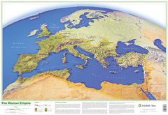
Map of The Roman Empire Poster
Suitable for: Key Stage 1 / Key Stage 2 level for ages 5 to 11
ISBN: 9780721709475
Availability:
Available Now
Retail Price:
£ 18.00
Teachers' Price:
£
12.00
Product description for teachers and tutors
This map shows the Roman Empire as it was in AD 106, in the reign of the Emperor Trajan, and illustrates the physical setting that greatly influenced how the Roman Empire grew. The map indicates provincial boundaries, Roman roads and Roman walls, and a description beneath the map explains how and why the empire expanded in the directions shown.
Dimensions: 53 x 77cm
Reviews
There are no product reviews, why not be the first to write a review for this product?
Free delivery
Free delivery on all UK orders over £20.


